In response to the demand for easier access to sea-level projections, a web mapping tool has been produced within the ERA4CS INSeaPTION and ECLISEA projects:
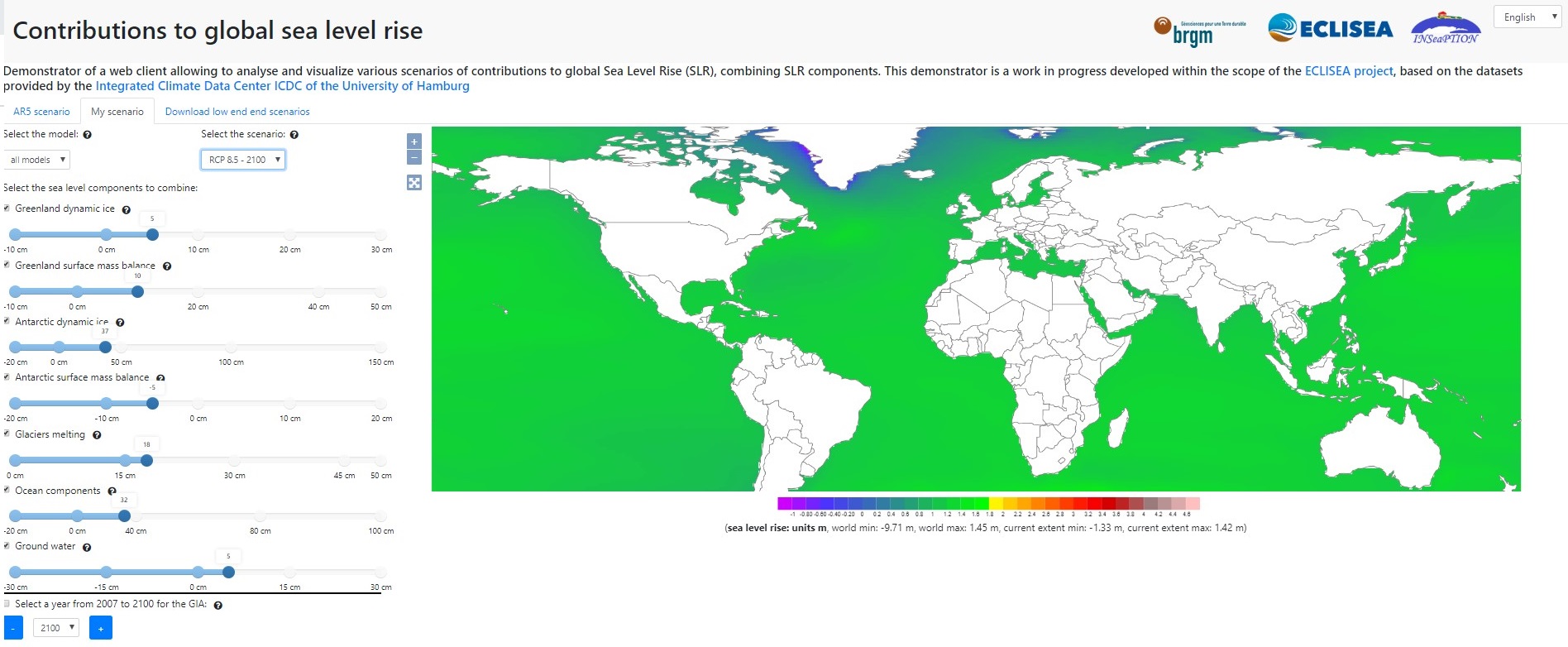
The tool allow users to vizualize and download projections of sea-level rise over the 21st century, including projections of the 5th assessment report of the IPCC (Internal Panel on Climate Change) and low end projections (https://www.mdpi.com/2073-4441/11/7/1507). It also includes interactive features allowing to produce user-defined scenarios based on assumptions on glaciers, ice-sheets, etc. The tool will be extended to include high-end projections as well as those from the Special Report of Ocean and Cryosphere (SROCC).
The tool has been produced by our colleagues Robin Quique, Rémi Thiéblemont and Agnès Tellez-Arenas, with support from sea-level scientists from the INSeaPTION and ECLISEA projects, as well as from the WCRP Sea-Level Grand Challenge. It uses data made available by the Integrated Data Center at the University of Hamburg in Germany (available as NetCDF datasets at https://icdc.cen.uni-hamburg.de/1/daten/ocean/ar5-slr.html). We are grateful to colleagues who shared their expertise to make this tool publicly available, especially colleaguies from the Universities of Hamburg, Utrecht and NIOZ.